
Walking is so relaxing and a great exercise, especially when we go at our own pace. This summer 2020 we really need to be outdoors after having been in quarantine and lockdown during the winter and spring corona virus scare. Finally things are getting back to normal and walking in nature is a great way to keep in shape while maintaining social distancing.
The fun thing in Prague is that when you get into any park or forest, even surrounded by the city it feels like being in the countryside. It is marvelous to be in a little oasis within the city. I had previously written about two walks to enjoy in spring. All of these walks can be done in most weather so enjoy them year round.
Please note that the ratings I give of moderate/difficult might mean that there are some hills or steps up, however, none of these walks are dangerous so if you are relatively fit and used to walking often they should be fine for you.
Baba-Dolní ŠárkaCircle (U Matěje) to Letohrádek:
Prague 6
Approx. 9 km
Moderate/difficult
How to get there and back:
– From Hradčanská or Bořislavka (Metro Green Line A) take bus 131 to U Matěje stop
– Take bus 131 back to Hradčanská or Bořislavka (Metro Green Line A)
This trail starts on the northeast side of the Divoká Šárka area. From the U Matěje bus stop walk north on the red trail. After a few minutes walking, take a detour on U Matěje Street to the Sv. Matěje Church. The pretty church and cemetery are worth visiting as it is especially known for its Perníkové jesličky (Nativity made from gingerbread). To see it during the year and non-service hours you will have to call the Church in advance as it is usually closed. Also of interest in the Church are the wonderful paintings of the Madonna by Czech artist Jiří Anderle.
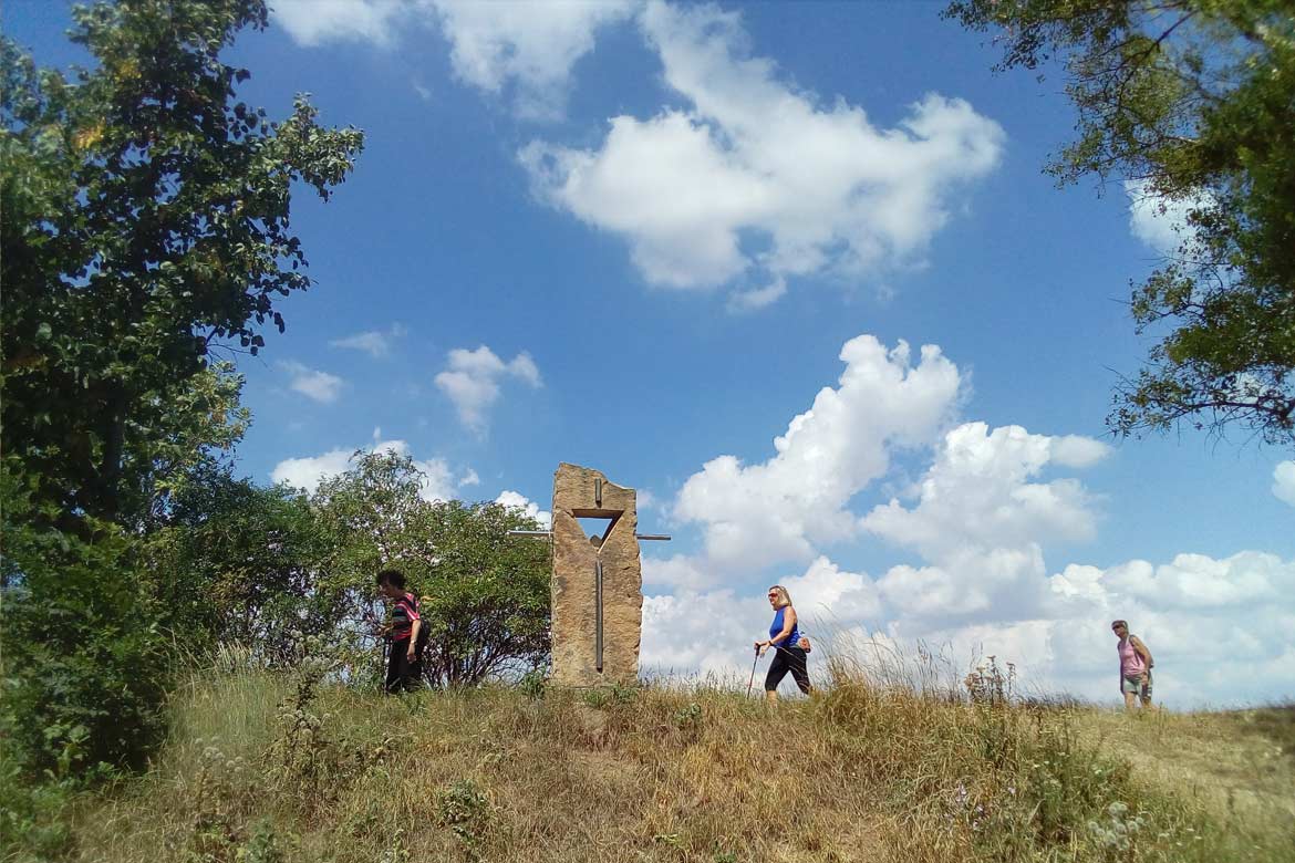
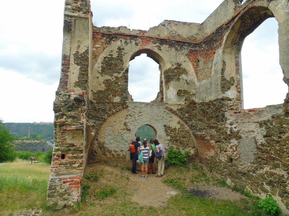
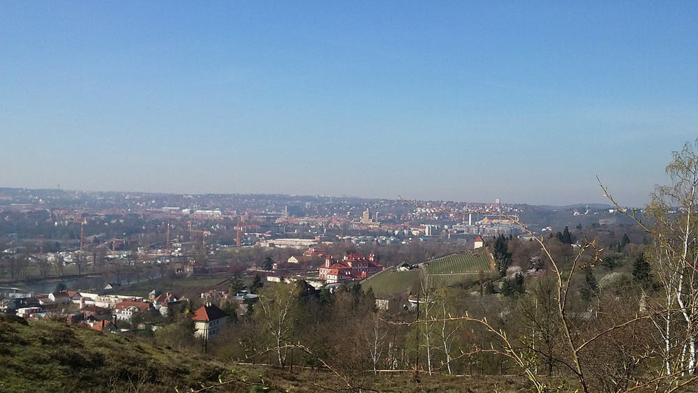
After exploring the Church, go back down and continue on the red trail going northeast. Walk uphill for another kilometer. You will pass interesting villas and also be sure to take a detour to the Baba Letohrádek ruins once you see the sign “Baba.” The Letohrádek was built in 1650 as a summer house and was at the time surrounded by vineyards. While the vineyards are now gone, it is worth going around the ruins and taking a look at the view onto the Vltava. Directly under the hill you will see an interesting hydroelectric power station and on the other side of the river are views of Prague Zoo and Troja.
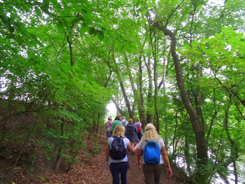
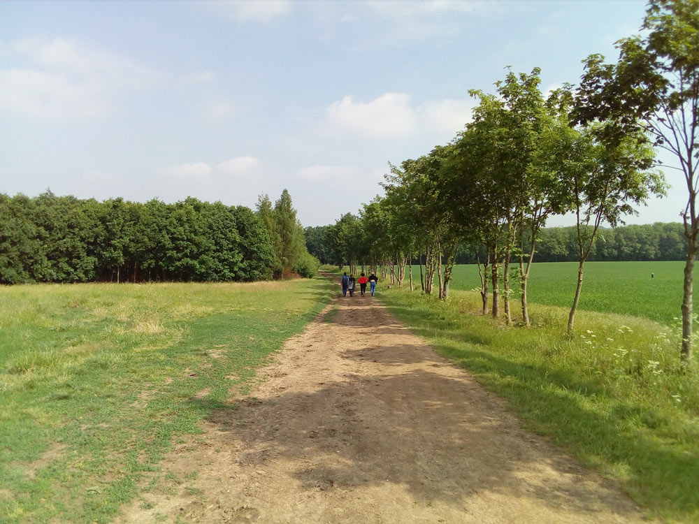
Get back on the red trail as now the paths will take you through a lovely green forest and pretty streams. After another kilometer, you will get to an open area and here you can enjoy great views of the Sv. Matěje Church which you visited earlier in the walk.
Continue walking on the red trail and once you cross the street V Šáreckém údolí you will see the signs where the red and blue trails meet. Be aware that at this point there is a steep uphill 15 minute walk. (There are buses on V Šáreckém údolí street to take back to the metro if you feel the uphill trek is too much for you.) Once you get up the hill and see the tree with the signs were the red/blue trail separates, continue walking on the red trail towards your left. Here the walk gets easier.
After another kilometer, you will see the blue trail again. Go towards the left and continue on the blue trail until you get back to the U Matěje bus stop. There are restaurants in the area where you can stop for refreshments before taking a bus to return to the metro.
Čimice to Staré Bohnice:
Prague 8
Approx. 6.5 km
Moderate/difficult
How to get there and back:
– From Kobylisy (Metro Red Line C) take bus 145 or 152 to Čimice stop
– Take bus 102 or 200 from Sídliště Bohnice stop back to Kobylisy (Metro Red Line C)
Take the blue trail walking west from the Sídliště Čimice bus stop. This is the Čimické údolí and Drahanské údolí (valley) area where you will pass a pretty pond and go through forests and fields.
Once you get near the river you will see a sign where the blue/red trail meet. Walk to the left and south on the trail along the river. When you see the “Zamky” trail sign, walk towards the right and continue on the blue trail. This is known as the Bohnické údolí (valley) area.
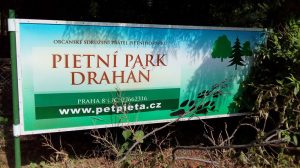
At one point you will get to the hiking signpost where the blue trail goes either straight or in a “V,” go towards the left to take a detour. Here at the end of the blue trail is a nice view “k vyhlídce.” After taking in the view, retrace your steps on the blue trail and once you get back to the little hut or shelter, take another detour as there is a pet cemetery at end of the little paved street after passing some cottages on the right and a regular cemetery on your left. This is the Pietní park Draháň or Pet Cemetery (Psí hřbitov). A beautiful little spot to explore.
Go back on the paved road you came on and continue on the blue trail going to the left. The blue trail will take you passed the pretty Peter and Paul Church, Chateau Bohnice and the Psychiatric Hospital complex for which the area is known. You will find the Staré Bohnice bus stop at the end of the blue trail. There are also many restaurants in the town if you want to stop for refreshments.
Troja to Ďáblický háj (grove):
Prague 8
Approx. 7 km
Moderate/difficult
How to get there and back:
– To Troja: From Nádraží Holešovice metro station (Metro Red Line C), take bus 112 (Zoo bus) to Kovárna bus stop.
– From Ďáblice: From K Letňanům bus stop (on Ďáblická Street) take bus 348, 368 or 369 to the Ládví metro (Metro Red Line C)
This trail will take you through three forested parks, Čimický háj, Ládví Park and Ďáblický háj.
Starting from the Kovárna bus stop, walk back in the direction the bus came from. Just around the corner from the bus stop is Pod Havránkou street where you will see signs for the green trail. Walk up and follow the green trail until you see a green arrow going towards your left. Here you will see some steps going uphill. This is the most difficult part of the walk as it is a steep climb but well worth the views of Troja chateau and the river from the top.
Once you go down from this hill, you will be walking in fairly flat ground. The green trail will take you across a major street (K Pazderkám). You will see many apartment blocks in this area. Cross the street at the crosswalk and watch the green arrow and trail signs going towards your right. At this point just walk along the sidewalk next to the street until you see the intersection with Čimická street. Cross here and continue walking straight for a little bit until you see the green arrow going into the forested area.
This wooded area within the city is Čimický grove. Continue in the paths along the woods and enjoy the bird song. Again at the end of this park following the green trail you will go to your left once you are out of the forest. There are markets, gas stations and also the Vozovna Kobylisy tram terminal in this area. Cross the major street (Horňátecká) and you will see that the yellow and green trails meet. Continue on the yellow and green trails in the forest area.
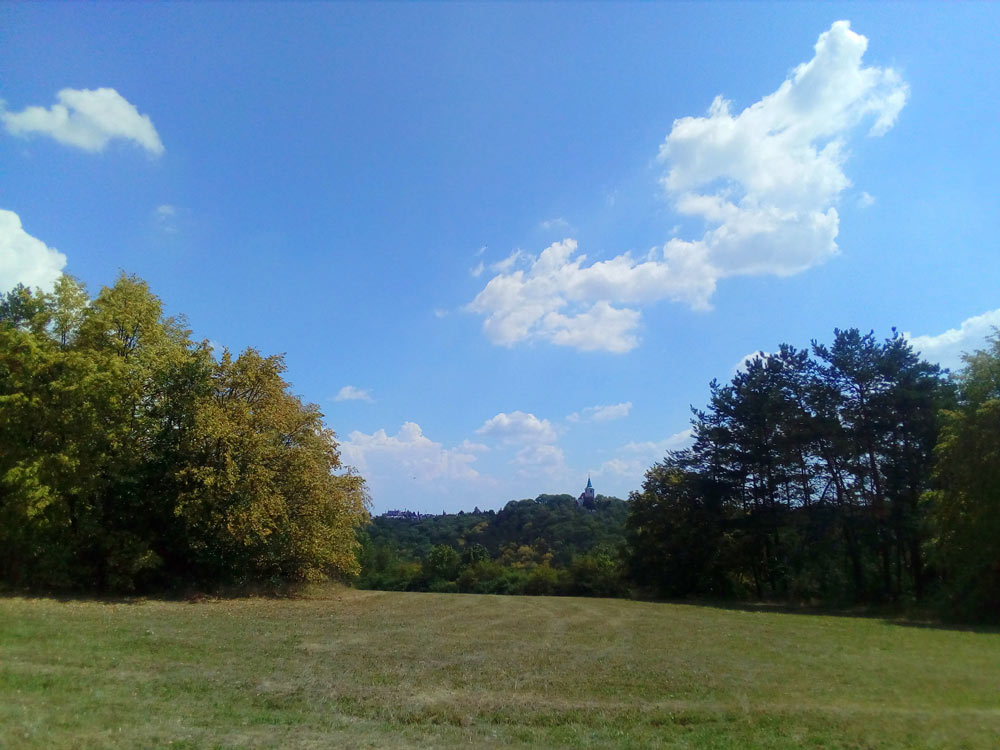
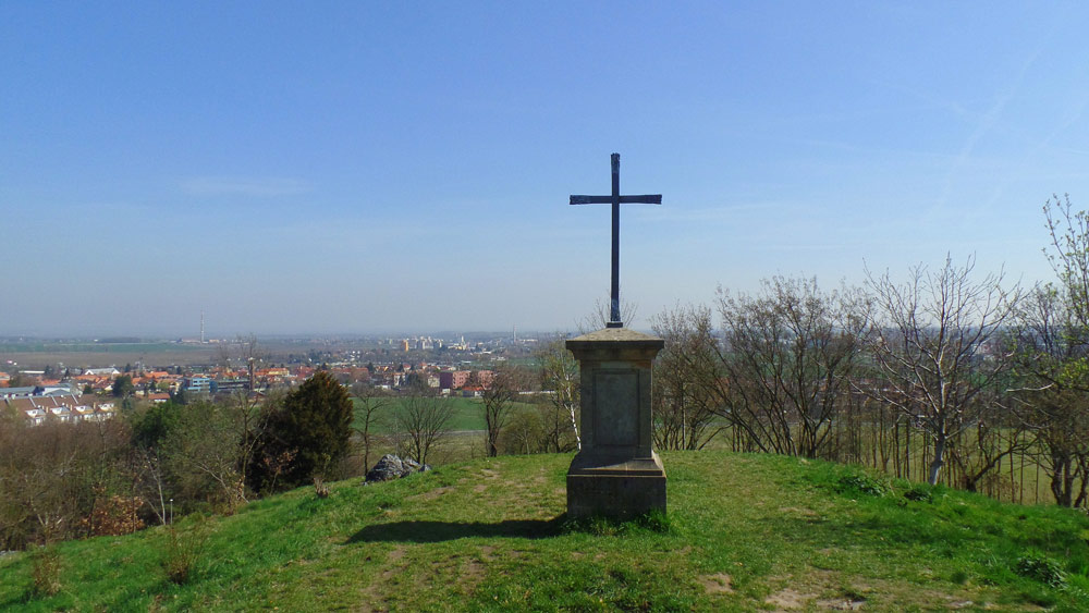
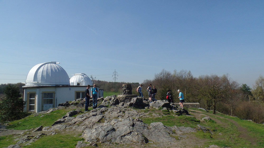
This is the Ládví Park and Ďáblický grove area. Once you see the yellow trail and the green trail separate at a fork, continue on the yellow trail at this point. Almost at the end of Ďáblický grove, take a little detour when you see the sign to the Hvězdárna Ďáblice (Observatory). Walk over the large rocks and behind the observatory there is a wonderful view of the countryside and of Letňany in the north Prague area.
Walk back to the street (Květnová street) along the yellow trail and go towards your right. Continue and before you get to Myslivecká street, there is a path going towards your right. Get off the yellow trail and take this path going straight into Mannerova Street around the odd building with a chimney tower. This is called Battistova cihelna and was previously a brickyard which was recently turned into a nice restaurant. Unfortunately, at the time of this writing it is closed. Go around this building and onto Hořínecká street going towards your right. Walk straight on Hořínecká until you get to Ďáblická street. Immediately to your right is the bus stop back into the center. There are various restaurants along this path where you can stop for refreshment.
Websites to help you on your walks:
Czech Hiking Group: http://www.kct.cz/cms/czech-tourist-klub-kct
Trails: https://en.mapy.cz/zakladni?x=14.4821000&y=50.1433000&z=11
Mapy.cz is now in English and other languages so just go to the bottom right of the page to change to your language of preference. To see the colored hiking trails or the bike trails, change the map to “Outdoor.”
Always be sure to check your transportation as schedules may change and travel directions from your starting point might be a little different for you than the general directions I have in this article.
Transportation within Prague: http://www.dpp.cz/en/
Transportation around the Czech Republic: http://jizdnirady.idnes.cz/vlakyautobusy/spojeni/
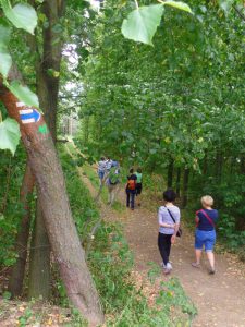
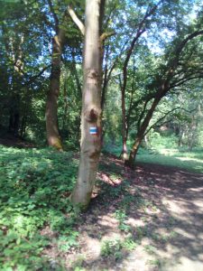
It is important to know and get used to the Hiking Group trail markings. For Hiking/Walking the markings are red, yellow, blue or green short stripes with white stripes on the top and bottom. The signs will be on trees, on posts or even on the ground so keep your eyes open as the trail might change all of a sudden. When there is a sharp right or left turn on a trail you will see an arrow with the same color as the trail. When two trails meet, you will see the signs with the two colors one on top of the other. Keep in mind that there are also markings for horse trails, educational trails or biking trails so don’t get confused. To follow, you will see a picture in the article of how your trail markings should look like.


